Backpacking the Mineral King Loop

I planned this trip after seeing a blog post about it and seeing that permits were available. I then invited Sam, who came over all the way from New York.
Trip stats
Distance: 30.2 miles
Time: 4 days
Dates: Aug 5 2022 - Aug 8 2022
Elevation change: +/-10500
Temperature: ~45-80 F
Permits required: Yes
Bear cans required: Yes
Caltopo map: https://caltopo.com/m/35LH2


Trail description, parking, and marmots
The loop is in the Mineral King area, which is in the southern end of Sequoia National Park. Getting to the trailhead requires driving 25 miles on the Mineral King road. This part of the road is windy and narrow at times and takes 1.5 hours to drive.
It seems more popular to hike the trail clockwise (starting from the Timber Gap trailhead) rather than counterclockwise (starting from the Sawtooth Pass trailhead). The trailhead determines which permit you have to get. We ran into one or two groups who said they were going counterclockwise because that was the only available permit remaining.

We did the hike in 4 days.
Day 1: 8 miles, +3300 ft, -2500 ft. This felt like a good amount of hiking for the first day, especially with a slightly late start. Camped at Pinto Lake; the campsite was a little crowded.
Day 2: also 8 miles, +3300 ft, -1800 ft. Almost all of the elevation was done the first half of the day, so it felt easier by the end of the day. Camped at the largest Big Five Lake, which was a small branch from the main loop trail.
Day 3: 10 miles, +3200 ft, -3000 ft. This day was longer than originally planned, since we went on to camp at Monarch Lake instead of in Lost Canyon. Monarch Lake is also a popular campground; we saw several large groups there.
Day 4: 4.5 miles, -2650 ft. Short day.
If I were to do this hike in 3 days and 2 nights, I would probably camp at Pinto Lake and Lost Canyon.

I had read about the parking lot marmot problem (evil marmots destroying your car), so we brought a tarp, but when we got to the trailhead no one else’s car was tarped, so we didn’t bother. After our hike we saw two cars with tarps. August is just after the end of the season in which tarps are recommended.
Weather
There was some thunder and rain on the forecast for the weekend; we got lucky and barely saw any. It was drizzling when we arrived at the ranger station, but it cleared up right as we started hiking. It also rained during the night on our third night at Monarch Lake.
The weather was fairly warm, probably in the 60s and 70s during the day and somewhere in the 40s at night. It did not feel warm enough to jump into any lakes.
Hiking log
Day 1: Timber Gap Trailhead to Pinto Lake (8 miles)
We drove up to the Mineral King ranger station right around 10am. It was drizzling and there was a small line to pick up permits. When getting our permit the ranger asked us about food storage and we hadn’t brought bear cans for this trip because I thought they weren’t required. Some of our planned campsites had bear storage containers, but not all, so the ranger made us rent a bear can. Apparently counterweighted hangs were also an accepted method of food storage. Our original planned itinerary was to camp at Pinto Lake, Big Five Lakes, and as far up Lost Canyon as possible. The ranger seconded that Lost Canyon would be a good camp spot for the reason of getting over Sawtooth Pass first thing in the morning in case of thunderstorms.

From the ranger station it was a short drive to the trailhead parking lot.

The rain stopped shortly after we started hiking. The trail up to Timber Gap was steadily uphill but not too steep. The recent rain led to a nice backdrop of clouds in the mountains.

At the top of Timber Gap we saw some other hikers.


After Timber Gap the trail goes downhill to cross Cliff Creek, then rises again toward Black Rock Pass. We passed by a ranger who checked our permits and told us that she had so far passed 10 people (or 10 groups?) camping at Pinto Lake so it would be pretty crowded.

We arrived at the Pinto Lake campground at about 7pm. It was in fact crowded, but we found a decent site. We didn’t actually see the lake (according to the map it should have been close to the trail, but maybe was hidden by some trees). We filtered our water at Cliff Creek, which was right by the campsite.

The site was in a wooded area. We found a spot to watch the sunset and had instant ramen for dinner.
Day 2: Pinto Lake to Big Five Lakes (8 miles)
The day started with a long uphill over Black Rock Pass, but the rest of the day was relatively easy.

From the trail up to Black Rock Pass you could see three lakes: Spring Lake, Cyclamen Lake, and Columbine Lake.

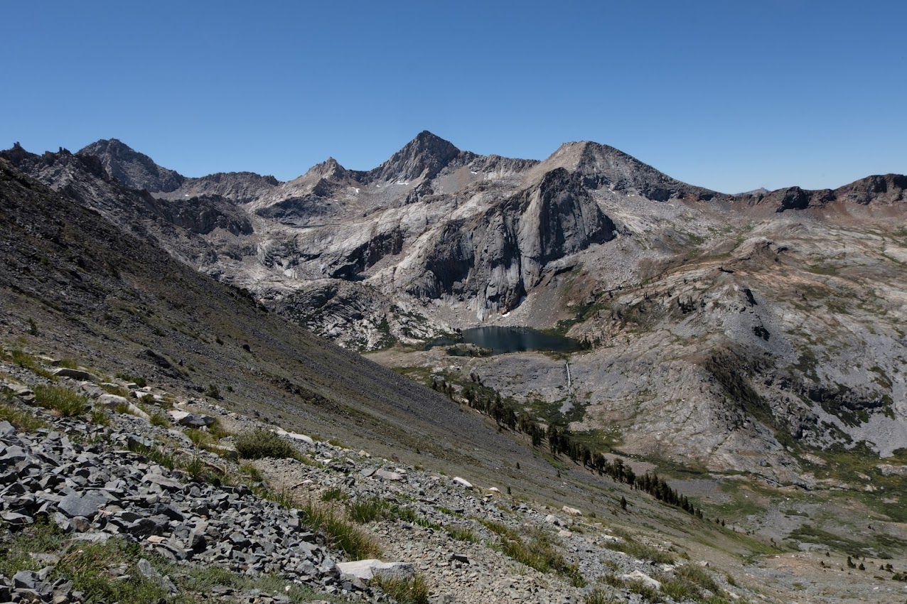
At the top of Black Rock Pass you can see more lakes on the other side; probably the Little Five Lakes and Big Five Lakes.
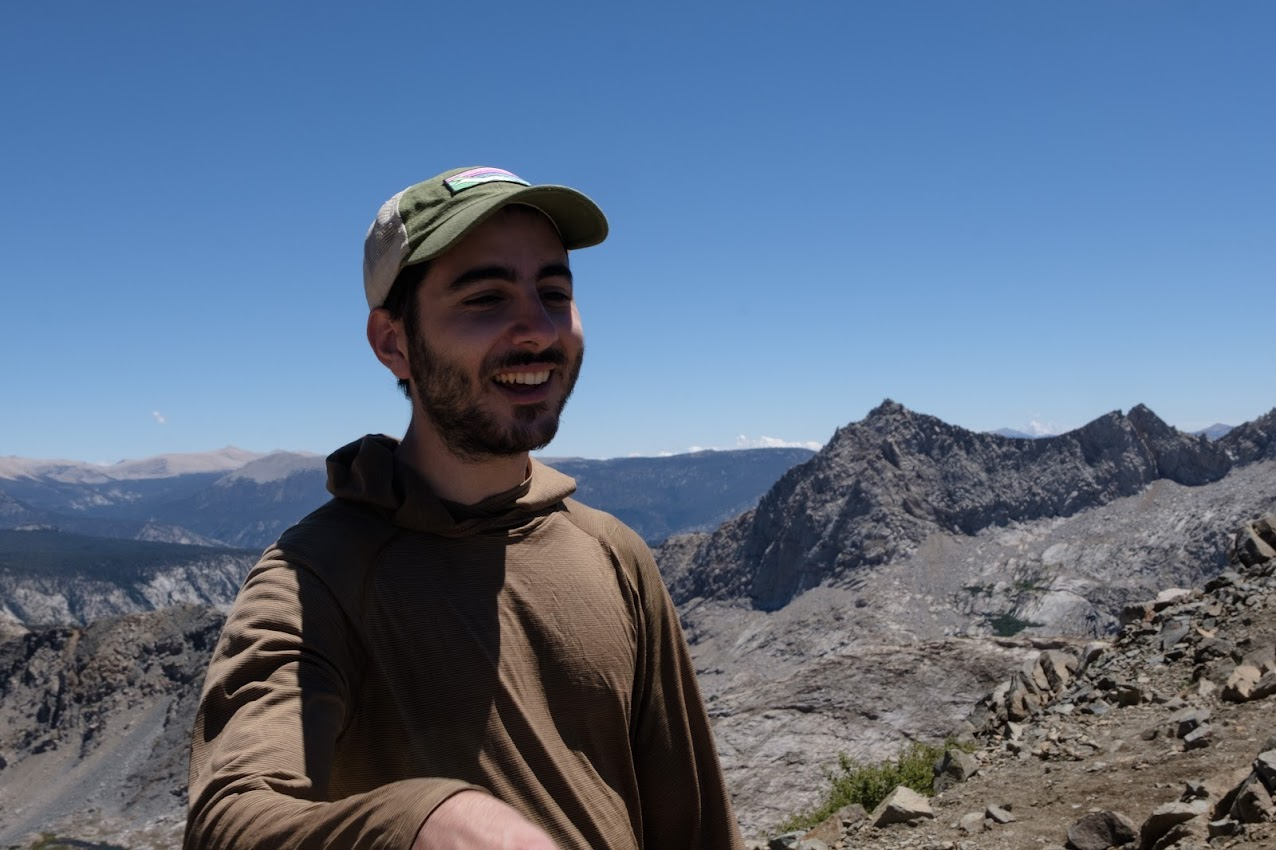
Here is Ryan talking about brown blazing to another group we met at the top of the pass. (Brown blazing is the questionable practice of trying to use only established restrooms while backpacking instead of digging holes outside even though the established restrooms are too far apart).
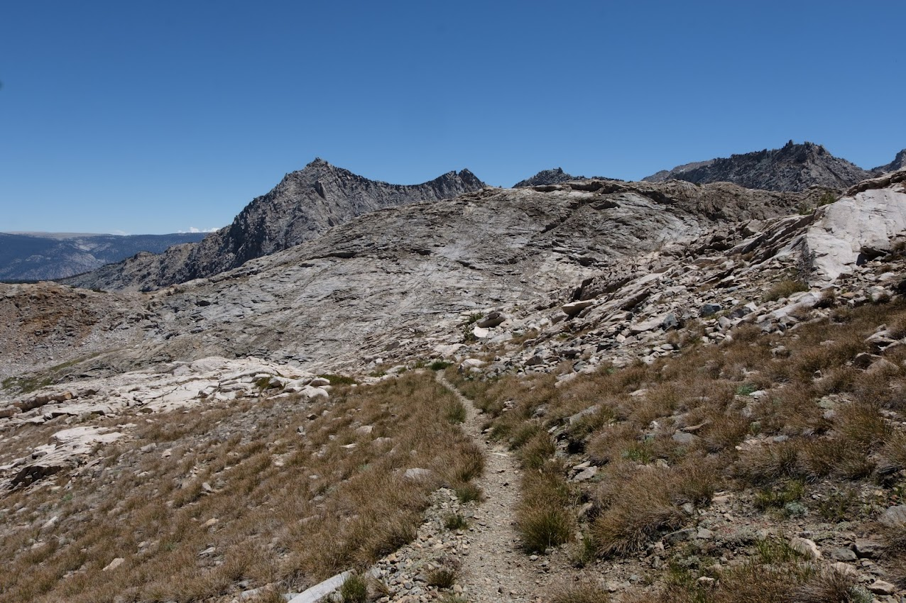

Then the trail descends quickly to one of the Little Five Lakes. This picture shows the one right by the trail.

About two miles later there's a small detour from the trail that leads to some of the Big Five Lakes. We ended up setting up camp near the largest Big Five Lake. We didn't see anyone else here even though there were a lot of people at Pinto Lake the night before.

There were a lot of fish creating ripples in the lake and at one point a fish jumped out of the water.

Day 3: Big Five Lakes to Monarch Lake (10 miles)
Our original plan for this day was to have a slightly short day and camp at the top of Lost Canyon right before the trail starts climbing to Columbine Lake, since that’s the last place camping is allowed before getting to the other side of Sawtooth Pass. Originally the ranger had advised us to camp there because there was a chance of thunder and it’s better to cross Sawtooth Pass earlier in the morning.
In the morning we considered going all the way to Monarch Lakes and decided to figure it out once we got to the camping spot at Lost Canyon.

The path from Big Five Lakes to Lost Canyon was a little uphill and mostly wooded. Lost Canyon was a nice open meadow area, with a stream going through the middle. The end of the canyon is a good spot for camping, with large boulders and good flat sandy areas for pitching tents. We reached that part a little after noon, and had a tortilla lunch. At this point a ranger was walking through and asked for our permit holder name (but not the actual permit). We asked how long it would take to get to Monarch Lakes, and after thinking for a bit he said 4 hours and 45 minutes. This turned out to be an oddly accurate estimate. It was about 1:30pm and the sky seemed clear so we decided to continue to Monarch Lakes.

The section going up to Columbine Lake was uphill but mostly switchbacks and not too steep.

Columbine Lake is nested in a high, rocky part of the mountain. Camping used to be allowed here, but not any more. It feels a bit exposed, especially with potential thunderstorms coming and some wind, but it would have been a beautiful spot to camp. We stopped for a bit to fill our waters and kept going.

The next section was steep and rocky, more of a scrambling than a walking trail. The route was marked with cairns because it wasn't obviously visible.

After that the trail became sandy and switchbacked up to Sawtooth Pass. It felt steep, but maybe we were just more tired and at higher elevation (around 11,600 ft?).


You get a good view of Sawtooth Peak from the pass. Apparently it's climbable, but it looks frightening.


The descent to Monarch Lakes is mostly sandy stuff that you can slide down. We were told previously by rangers to not go directly down because of how steep it is, and to instead do a little detour around the side, so we tried to do that. I think we might have detoured too far, though, because we then had to cut across a significant amount to the left, which was somewhat sketchy, and added a ton of time to the hike. Looking back from Monarch Lake, it would have been much faster to just go directly down, and sliding down steep sand is actually much easier than walking down a steep gravel or dirt trail.


We reached the campground right before sunset. This campsite had somewhat designed areas for camping, and even had a pit toilet (with three walls, no door, and a plank for a toilet lid). It was pretty busy, with a few large groups. There was also a bunch of wildlife here. A few deer walked through the site when we first got there. Right before going to bed, we saw some mice in Ryan's backpack. There were also several white-tailed ptarmigans.
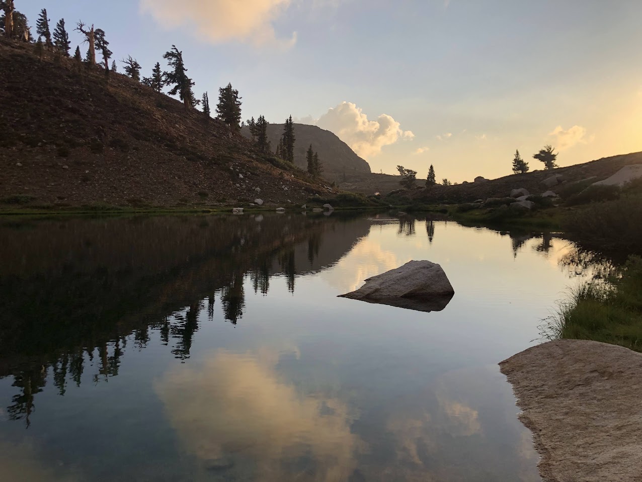


Another instant ramen dinner with sunset view.

Day 4: Monarch Lake to Trailhead (4.5 miles)

The hike out was pretty short and straightforward. We saw two marmots. Despite the marmots our car was safe and we were able to drive home.