A backpackin night in Joshua Tree

For Thanksgiving Ryan and I decided to bring my sister on her first backpacking trip. We picked Joshua Tree because it's nearby and a relatively easy, flat hike and because I like Joshua Tree. There was a great lack of planning for this trip. The day before we left, I was browsing Alltrails and found "California Riding and Hiking Trail: Ryan Campground to Twin Tanks Section". I was somewhat familiar with the California Riding and Hiking Trail, and want to do it someday, but the full 38 miles was too long for this trip, and this section seemed nice and central.
Because we were flying down, we didn't want to pack too much stuff, so we didn't bring a tent. (We would have had to bring two 2-person tents.) We also only had two backpacking packs for the three of us, but that was fine because we weren't bringing much. I also didn't bring a camera. All of our stuff fit into one checked suitcase.
An approximate packing list:
- 2 backpacking packs
- Day hiking pack
- Double sleeping quilt (20 deg)
- Sleeping bag (20 deg)
- 2 inflatable sleeping pads
- 1 foam sleeping pad
- 2 plastic ground sheets
- 6 assorted 2-3L water bladders
- Some water bottles
- Headlamps
- Clothing (puffy jackets, socks, beanies, gloves)
- Misc (hygiene stuff, chargers, etc)
The trail is very flat, with almost no elevation gain, especially in the west to east direction. It crosses the Geology Tour Road at about halfway through this section. Right before getting to the Geology Tour Road there's a group of rock piles to the right of the trail. We camped there, and also found a man-made dam. After crossing Geology Tour Road there are more rocks to the left that also looked like good camp spots.
Trip stats
Distance: 10.8 miles
Time: 2 days
Dates: Nov 23 2022 - Nov 24 2022
Elevation change: +532/-1050 feet
Temperature: ~40-60 F
Permits required: No (at least for now)
Bear cans required: No


Hiking log

We started at Ryan Campground at about 1:30pm. The trail was very nice, flat and sandy so walking went quickly. Every mile was also clearly marked. We started the trail at mile marker 18. Since the total mileage was around 10 miles we wanted to find a camping spot around 5 miles in. Because we didn't have a tent I was a little concerned it would be too windy.


We saw a nice split rock so we decided to climb on top of it.

There was a pile of pink rocks, maybe quartz?


At around the 13 mile marker, we saw some large rock piles to the right of the trail, which seemed like a good place to camp. The map showed a little turn off from the trail that seemed to go to the rock piles. The turn off was marked with three buried horizontal joshua tree segments.

We lost the trail a little way in so we just walked until we got to the rock pile.


Probably the most interesting thing here was this dam-like structure. The dirt behind the dam was damp; maybe there was water here recently. In the area we saw some planks of wood with bent nails stuck inside. There were also the remnants of a campfire and a wrapped bundle of firewood, probably from some other campers. I was curious about this dam so after the trip I tried looking for information about it online, but the only mention of it that I found was this blog post. Although this particular dam seems relatively unknown, there are apparently lots of other dams, or "tanks", in Joshua Tree.

We set our sleeping spot right on top of the used campfire. We didn't bring a tent, so we just laid our plastic tarps, sleeping pads, and sleeping bags down. The dirt in the area was very damp, and there were large meadows of green grass, which felt unusual to see in Joshua Tree. Also interesting to note is that there are hardly any bugs in Joshua Tree, which is the only reason I am willing to camp tentless. I don't think I recall ever seeing a bug in Joshua Tree, although there must be some out there. For dinner we picked a rock and watched the sunset while eating salami sandwiches.
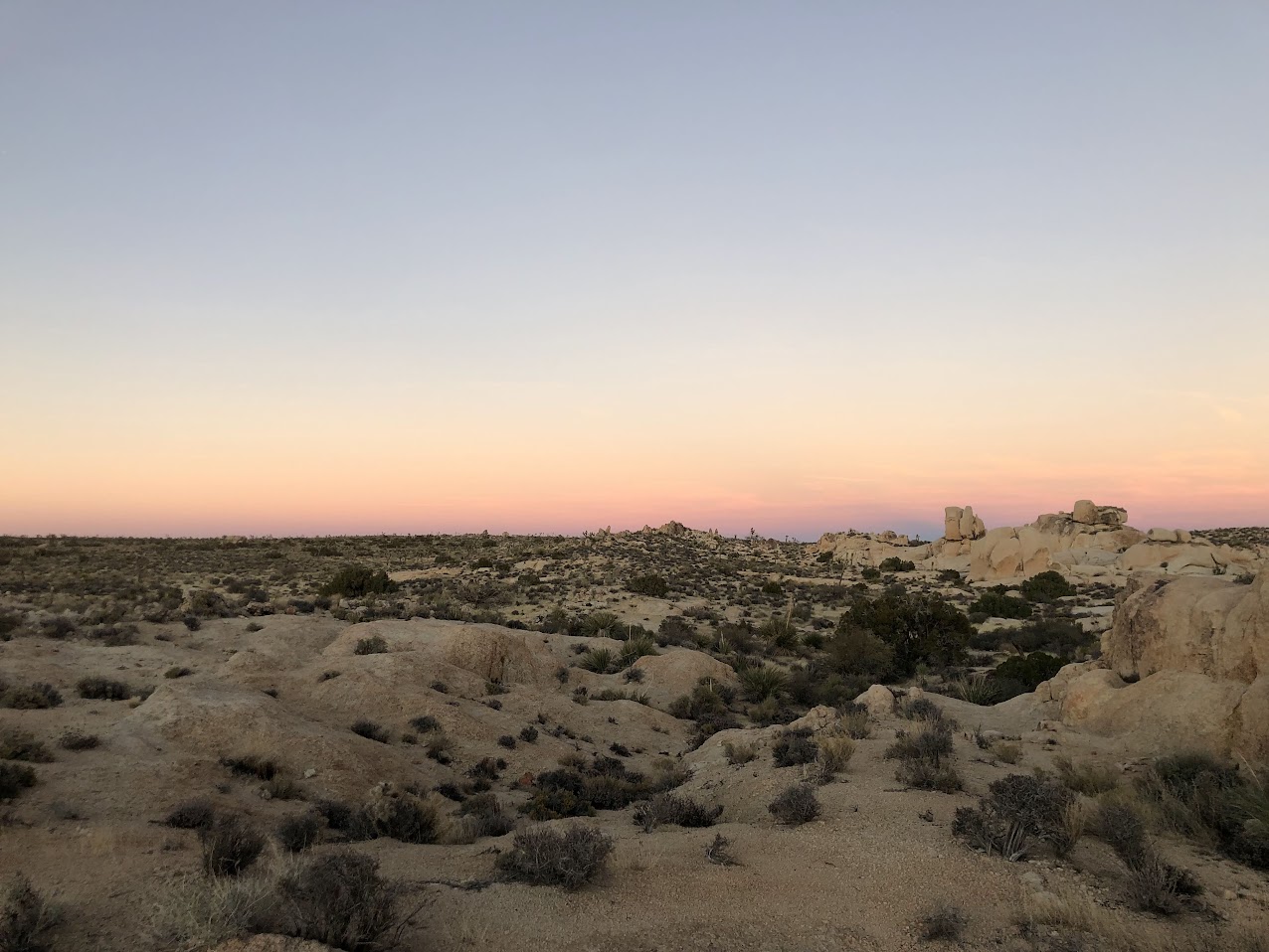
Sunset was around 4:45pm; by 5:30 it was dark. So we were lying in our sleeping bags for a while just looking at the stars. It happened to be a new moon, so the stars were very visible. We even saw a few meteors. Shortly after sundown several bats flew above us. Sometime later in the middle of the night we heard a group of coyotes howling. There was almost no wind until early morning, maybe 3am or so.

Breakfast and the rest of the hike out continued to be windy. The end of the section meets up with the Arch Rock trail to White Tank Campground so we walked through that trail and read some of the informational signs about rock formations.